Net Viewer Efficient Link Planning Tool
Design your Point-to-Point and Point-to-
Multipoint Networks for operational excellence and resource utilization.
Design Your Networks with Wireless Net Viewer
We know exactly what it takes to successfully deploy a microwave network. It starts with accurate link path planning. There’s enough complexity in wireless networking without adding more, so our advanced link planner i.e.Net Viewer’s allows you to craft efficient networks for optimal deployment and performance. Simulate fixed wireless scenarios, considering geography, distance, antenna elevation, and power.Net Viewer’s’s cross-platform compatibility and industry reliability make it the top choice for RF link planning. Plan and optimize communication links precisely, accounting for all power losses.Net Viewer’s is compatible with Microsoft® Windows®, Mac®, and Linux platforms offering free, user-centered network design software.

3 Easy Steps to Use LinkXpert
All Features
Think Ahead Plan
Smart with Link Planner
Think Ahead Plan Smart with Link Planner

Point-to-Point Link Planning
Effortlessly manage your entire network through a single, user-friendly dashboard with UcNMS. Streamline operations by accessing a centralized platform that oversees all network components, providing unparalleled convenience.

Point-to-Multipoint Link Planning
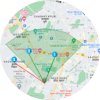
For Point-to-Multipoint (PTMP) links, design complex networks with up to 12 CPEs. Visual aids on the map showcase the base station and CPE locations with markers. The base station's coverage is displayed through the link design tool using a sector.

Google Maps Integration
Our RF link design tool seamlessly integrates Google Maps to enhance your planning process, allowing you to visualize base station and CPE locations with markers. It also displays elevation data from Google Maps API, ensuring accurate terrain profile assessment.

Installation Report
Generate comprehensive installation reports for your links. The reports generated through the user-friendly link design tool can be exported as Excel files or downloaded as PDFs. They contain crucial information about link parameters, calculations, and site details.

Model and Modulation Support
Our Link planner supports the latest 1 Gbps and 2 Gbps UBR models, enabling you to achieve MCS 11 modulation. This compatibility ensures that you can plan links with the latest technology, optimizing your communication infrastructure.

Country Support & Customization
Net Viewer is designed for global use. With support for 196 countries, this link-building expert allows you to plan links anywhere in the world. Additionally, the network design tool offers the flexibility to plan without country restrictions, catering to various scenarios and requirements.
Plan Your Network Now


Best Results
Prepare for the Unexpected
Net Viewer ensures your network remains resilient. From theoretical to real-world scenarios, it equips you to plan for optimal network performance.


Best Results
Precision Planning with Net Viewer
Experience precision in network planning with the ultimate design tool, offering line-of-sight diagrams, Fresnel zone plotting, and elevation data for accurate link planning.
Plan Networks Across 196 Horizons: Your Global Support Hub!

North America

Africa

Europe

South America

Asia

Australia
Frequently Asked Questions
For PTMP links, Net Viewer supports up to 12 CPEs, enabling the design of intricate networks.
For Outdoor Access Points with Integrated antenna the typical range is 80-100m. However, it depends on the location where access point is deployed for example- existence of concrete walls, buildings and interference in the environment etc. For Outdoor APs with External antenna range depends on Gain of antenna.
Link planner is cross-platform compatible, working seamlessly with Microsoft® Windows®, Mac®, and Linux.
The Google Maps integration provides accurate elevation data, visual aids for base station and CPE locations, and a sector representation for the base station’s coverage. It ensures precise terrain profile assessment and enhanced visualisation.
Yes, Net Viewer allows you to generate detailed installation reports. These can be exported as Excel files or downloaded as PDFs, providing essential link parameters, calculations, and site details
Link planner is a specialized software tool designed for planning and optimizing communication links in various networking scenarios. It allows users to model and simulate different aspects of wireless communication, such as Point-to-Point and Point-to-Multipoint networks. With features like the ability to consider factors like geography, distance, antenna height, transmit power, and more, Link planner helps in optimizing system performance before the actual deployment. It is a crucial tool for designing efficient networks, and ensuring optimal performance.
The terrain profile in link planner offers a detailed view of the geographical landscape along communication paths. It helps identify potential obstacles, ensuring optimal signal transmission and reliable wireless connections.
Link planner utilizes Fresnel zone information to minimize signal blockage caused by obstacles within the communication path. By strategically considering this elliptical area, users can optimize communication paths, reducing the impact of obstructions on signal quality.
Yes,Net Viewer allows users to input information about buildings or obstructions that might impact link planning. This feature ensures that the link calculations take into consideration real-world obstacles, contributing to the overall accuracy of the link planning process.


